SOHLA
Jump to: Mission Objectives, Mission Instrumentation, Mission Parameters, Additional Information
Mission Photos:

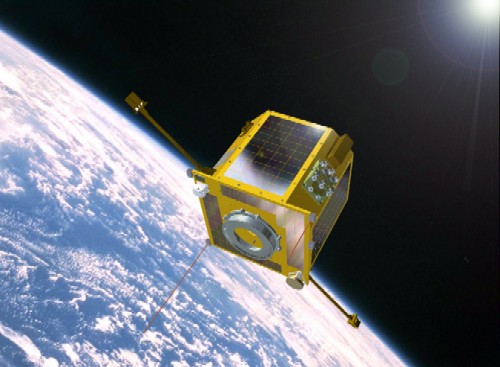
SOHLA-1 (Courtesy of JAXA)
Mission Objectives:
SOHLA-1 is a technical demonstration satellite developed by local SMEs (small and medium-sized enterprises) with technical support of Japan Aerospace Exploration Agency (JAXA) and Osaka Prefecture University. Development was initiated by SOHLA, the Space Oriented Higashiosaka Leading Association. The main objective of SOHLA-1 is to acquire and to accumulate various technologies for small satellite development. Another mission of SOHLA-1 is on-orbit demonstration of several new technologies such as the VHF lightning impulse measurement . SLR will be used for the calibration of GPS-based satellite positioning. The micro GPS receiver used in this mission has been developed by JAXA based on COTS automobile navigation technology.
Mission Instrumentation:
SOHLA-1 has the following scientific instruments:
- GPS receiver
- Laser retroreflector array
SOHLA-1 Mission Parameters:
| Sponsor: | JAXA |
| Expected Life: | 1 year |
| Primary Applications: | Technology demonstration |
| Primary SLR Applications: | Calibration of GPS orbits |
| COSPAR ID: | 0900205 |
| SIC Code: | 1580 |
| Satellite Catalog (NORAD) Number: | 33496 |
| Launch Date: | 23-Jan-2009 |
| NP Bin Size: | 5 seconds |
| RRA Diameter: | 16 cm |
| RRA Shape: | hexagonal |
| Reflectors: | 12 corner cubes |
| Altitude: | 666 km |
| Inclination: | 98.06 degrees |
| Eccentricity: | 0.001 |
| Orbital Period: | 1.6 hours |
Additional Information:
Web sites:


