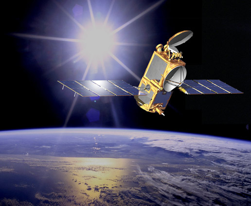
Jason-2
Jump to: Mission Objectives, Mission Instrumentation, Mission Parameters, Additional Information
Mission Photos:

Courtesy of Courtesy of NASA/JPL-Caltech
Mission Objectives:
Jason-2, also known as the Ocean Surface Topography Mission (OSTM), will continue the oceanography program begun by the TOPEX/Poseidon and Jason-1 missions. Jason will continue to monitor global ocean circulation, discover the tie between the oceans and atmosphere, improve global climate predictions, and monitor events such as El Nio conditions and ocean eddies. The CNES, Eumetsat, NASA, and NOAA cooperative mission will carry nearly the same payload as Jason-1. The satellite's payload will include the next generation of Poseidon altimeter (Poseidon-3, with the same general characteristics as Poseidon-2, but with a lower instrumental noise and an algorithm enabling a better tracking over land and ice). The accuracy should be of about 1 cm on the altimeter as well as the orbit measurements.
The Time Transfer by Laser Link (T2L2) payload, initially planned to be embarked on MIR in 1999, then with the ACES mission on the ISS, has recently been accepted by the French space agency CNES as a passenger of the Jason-2 altimetry satellite. T2L2 on Jason-2 will allow the precise characterization of the USO (ultra-stable oscillator) used by the DORIS positioning system. Relying on this clock, T2L2 may also be able to perform some orbit restitutions of Jason-2 uniquely by one-way laser ranging. Jason-2 represents an excellent opportunity as its high altitude allows for time transfer with very long integration times in common view mode for most of the continental links.
Mission Instrumentation:
Jason-2 will have the following instrumentation onboard:
- CNES Poseidon-3 altimeter
- NASA Advanced Microwave Radiometer (AMR), three-frequency
- CNES DORIS receiver
- NASA GPS receiver
- NASA retroreflector array
- Time Transfer by Laser Link (T2L2) payload
Mission Parameters:
| Sponsor: | NASA, CNES, Eumetsat, NOAA |
| Expected Life: | 5 years |
| Primary Applications: | oceanography and climate change |
| Primary SLR Application(s): | calibrate satellite altimeter |
| COSPAR ID: | 0803201 |
| SIC Code: | 1025 |
| Satellite Catalog (NORAD) Number: | 33105 |
| Launch Date: | June 20, 2008 |
| RRA Diameter: | 16 cm |
| RRA Shape: | hemispherical |
| Reflectors: | 9 corner cubes |
| Orbit: | circular |
| Inclination: | 66 degrees |
| Eccentricity: | 0.000 |
| Perigee: | 1336 km |
| Period: | 112 minutes |
| Weight: | 500 kg (fueled) |
Additional Information:
Web sites:
- NASA JPL
- Eumetsat
- CNES
- NOAA
- Archiving, Validation and Interpretation of Satellite Oceanographic data (AVISO)
- T2L2 at OCA
Publications:
- Bloßfeld M., Zeitlhofler J., Rudenko S., Dettmering D., "Observation-Based Attitude Realization for Accurate Jason Satellite Orbits and Its Impact on Geodetic and Altimetry Results", Remote Sensing, 12(4), 682, DOI: 10.3390/rs12040682
- Jason-2 LRA field of view documentation
- Jason-1/2 SLR Tracking Status (09/2008)


