NPOESS
Jump to: Mission Objectives, Mission Instrumentation, Mission Parameters, Additional Information
Mission Photos:
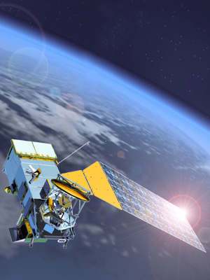
Courtesy of NOAA
Mission Objectives:
The National Polar-orbiting Operational Environmental Satellite System (NPOESS) is a satellite system used to monitor global environmental conditions, and collect and disseminate data related to: weather, atmosphere, oceans, land and near-space environment. In 1994, it was recognized that converging the existing polar systems from the Department of Commerce (DoC) and Department of Defense (DoD) would result in a more cost effective and higher performance integrated system. Converging U.S. polar-orbiting satellite programs, the National Polar-orbiting Operational Environmental Satellite System will reduce the number of polar-orbiting systems from four U.S. satellite groups to three. NPOESS has initiated a systematic program of convergence projects (sensors, concept demonstrations, and with NASA, the NPOESS Preparatory Project). The Integrated Program Office has initiated planning and development programs of satellite transition, sensor development and user training.
Mission Instrumentation:
The National Polar-orbiting Operational Environment Satellite System (NPOESS) will collect and disseminate data about the Earth's oceans, atmosphere, land, climate, and space environment. These environmental measurements are made available by a variety of instruments (sensors) both new and existing. The following lists the various sensors:
- VIIRS Visible/Infrared Imager/Radiometer Suite
- CMIS Conical Microwave Imager/Sounder
- CrIS Crosstrack Infrared Sounder
- OMPS Ozone Mapping and Profiler Suite
- SESS Space Environment Sensor Suite
- APS Aerosol Polarimeter Sensor
- ATMS Advanced Technology Microwave Sounder (currently under development by NASA)
- DCS Data Collection System
- ERBS Earth Radiation Budget Sensor
- RADAR Altimeter
- SARSAT Search and Rescue Satellite Aided Tracking
- TSI Total Solar Irradiance Sensor
- ASCAT Advanced Scatterometer (ESA)
- Retroreflector array
Mission Parameters:
| Sponsors: | NOAA, NASA, DoD |
| Expected Life: | 7 years |
| Primary Applications: | Sea syrface height |
| Primary SLR Applications: | precision orbit determination |
| COSPAR ID: | TBD |
| SIC Code: | TBD |
| NORAD SSC Code: | TBD |
| Launch Date: | 2013 |
| NP Bin Size: | TBD |
| RRA Diameter: | TBD |
| RRA Shape: | TBD |
| Reflectors: | TBD |
| Orbit: | polar |
| Inclination: | 98.7 +/- 0.05 degrees |
| Eccentricity: | 0.0011 |
| Altitude: | 833 +/- 17 km |
| Weight: | ~550 kg |