Quick Links
- Network Map
- List of Stations
- Monthly Report Card
- Quarterly Report Card
- Network Status Page
- Potsdam CPF time bias service
- Procedure for estimating laser beam divergence
- Recent Station Upgrades
- Network station application form
- Revised ILRS station screening process at ILRS Operations Centers (NASA and EDC)
Data
Performance
Mt. Stromlo
Jump to: Photo, Contact, Coordinates, News, Links
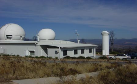
Mt. Stromlo Contact:
| Agency | EOS Space Systems Pty. Ltd. |
| Mailing Address | 18 Wormald Street Symonston, ACT 2609 Australia |
| Primary Contact | |
| Contact Name | Dr Michael Lachut |
| Telephone (primary) | +61 2 6222 7927 |
| Telephone (secondary) | |
| Fax | |
| mlachut@eosspacesystems.com | |
| Secondary Contact | |
| Contact Name | |
| Telephone (primary) | |
| Telephone (secondary) | |
| Fax | |
Mt. Stromlo Coordinates:
Approximate Position:
| X coordinate | [m] | -4467064.95 |
| Y coordinate | [m] | 2683034.89 |
| Z coordinate | [m] | -3667007.12 |
| Latitude | [deg] | 35.3161 S |
| Longitude | [deg] | 149.0099 E |
| Elevation | [m] | 805.0 |
| Survey Method | ||
| Date Measured | ||
| Additional Information | From 2014 Mount Stromlo Co-location survey GA report 2016 |
|
Mt. Stromlo News:
Local Events:
| Date | 2003-01-18 HH |
| Event | Fire storm |
| Additional Information | SLR station destroyed along with GPS, Doris and Glonass monitoring equipment. Monuments AU045 (STR2) and AU052 (STR1) not destroyed but required refurbishment. A post-fire survey confirmed that these marks had not moved. |
SLRMail Messages:
No SLRMail mesages found.Mt. Stromlo Link:
Mt. Stromlo: Site Log
Instructions and Update Site Log
You can use the hyperlinks to quickly get to the section of interest or you can scroll down to read them all.
Section: 0. Form
Section: 1. Identification of the Ranging System Reference Point (SRP)
Section: 2. Site Location Information
Section: 3. General System Information
Section: 4. Telescope Information
Section: 5. Laser System Information
Section: 6. Receiver System
Section: 7. Tracking Capabilities
Section: 8. Calibration
Section: 9. Time and Frequency Standards
Section: 10. Preprocessing Information
Section: 11. Aircraft Detection
Section: 12. Meteorological Instrumentation
Section: 13. Local Ties, Eccentricities, and Collocation Information
Section: 14. Local Events Possibly Affecting Computed Position
Section: 15. On-Site, Point of Contact Agency Information
Section: 16. Responsible Agency (if different from 15.)
Section: 17. More Information
ILRS Site and System Information Form
International Laser Ranging Service
0. Form
Prepared by (Full Name) : Abdu Abohalima
Preparer E-mail : aabohalima@eosspacesystems.com
Date Prepared : 2024-05-30
Report Type : UPDATE
Site Log Format Version : 2.0
Site Log Revision : 2
Back to top
1. Identification of the Ranging System Reference Point (SRP)
Site Name : Mount Stromlo
IERS DOMES Number : 50119S003
CDP Pad ID : 7825
Subnetwork : WPLTN
Description : AZ EL INTERSECT
Monument Description : N.A.
Monument Inscription : N.A.
Mark Description : N.A.
Date Installed : 2004-04-08
Date Removed :
Geologic Characteristic : BEDROCK
Additional Information : Bedrock is FRESH IGNEOUS.
: Installation date is of first system
: acceptance. Operations started 2004-11-01.
Back to top
2. Site Location Information
City or Town : Canberra
State or Province : Australian Capital Territory
Country : Australia
Tectonic Plate : Australian-Indian
Local Time (UTC +/- hours) :
Approximate Position
X coordinate [m]: -4467064.95
Y coordinate [m]: 2683034.89
Z coordinate [m]: -3667007.12
Latitude [deg]: 35.3161 S
Longitude [deg]: 149.0099 E
Elevation [m]: 805.0
Survey Method :
Date Measured : 2014-09-01
Additional Information : From 2014 Mount Stromlo Co-location survey
: GA report 2016
Back to top
3. General System Information
3.01 System Name : Stromlo
4-Character Code : STL3
CDP System Number : 90
CDP Occupation Number : 01
Eccentricity to SRP (if Not Identical With SRP)
North [m]:
East [m]:
Up [m]:
Date Measured : N.A.
Date Installed : 2004-04-08
Date Removed :
Additional Information :
Back to top
4. Telescope Information
4.01 Receiving Telescope Type : Confocal paraboloid (Mersenne)
Aperture [m]: 1.00
Mount : AZ-EL
Date Installed : 2004-04-08
Date Removed :
Xmitting Telescope Type : Confocal paraboloid (Mersenne)
Aperture [m]: 1.00
Date Installed : 2004-04-08
Date Removed :
Tracking Camera Type : CCD
Model : Andor Luca
Manufacturer : Andor
Field of View [deg]: 0.07
Minimum Magnitude [mag]: 10
Date Installed : 2010-04-12
Date Removed :
Transmit/Receive Path : COMMON COUDE
Transmit/Receive Switch : ROTATING MIRROR
Max Slew Rate Az [deg/s]: 8
Max Slew Rate El [deg/s]: 2
Max Used Tracking Rate Az : 8
Max Used Tracking Rate El : 2
Telescope Shelter : SEALED DOME Typhoon
Daylight Filter Type : Semrock LL01-532-25 bandpass
Dayl. Filt. Bandwidth [nm]: 2.0
Adjustable Attenuation : no
Adjustable Field of View : no
Transmit Efficiency : 0.95
Receive Efficiency : 0.95
Date Installed : 2011-05-24
Date Removed :
Additional Information : Secondary mirror diameter 0.25 m
Back to top
5. Laser System Information
5.01 Laser Type : ND:YAG
Model :
Manufacturer :
Number of Amplifiers : 2
Primary Wavelength [nm]: 1064
Primary Maximum Energy [mJ]: N.A.
Secondary Wavelength [nm]: 532.1
Secondary Max. Energy [mJ]: 13.5
Xmit Energy Adjustable : NO
Additional Information :
Pulse Width (FWHM) [ps]: 12
Max. Repetition Rate [Hz]: 30
Fullw. Beam Divergence ["]: 07 - 60
Theoretical Beam Div :
Measured Beam Div :
Method Used :
Additional Information :
Final Beam Diameter [m]: 1.00
Eyesafe : NO
Eyesafe Standard : AS/NZS 2211.1:1997
Polarization on Exit : NO
Laser Fire Control : controlled
Laser Energy Monitor : continuous
Start Diode Type : InGaAs
Manufactorer : Perkin Elmer
Model : C30617B
Quantum Efficiency [%]:
Rise/Fall Time [ps]: 70
Date Installed : 2004-04-08
Date Removed : 2017-06-26
Signal Processing :
Manufacturer :
Model :
Date Installed :
Date Removed :
Additional Information :
Date Installed : 2004-04-08
Date Removed : 2007-07-17
Additional Information : Passively mode-locked oscillator at 100 MHz
: nanojoule region. Pulses selected and
: amplified in a Regenerative amplifier, then
: fed to a double pass power amplifier.
: Beamwidth 9mm, divergence 155 at laser
: Output
: Used in conjunction with Aircraft Detection
: Laser (see 11.01)
5.02 Laser Type : ND:YAG
Model :
Manufacturer :
Number of Amplifiers : 2
Primary Wavelength [nm]: 1064
Primary Maximum Energy [mJ]: N.A.
Secondary Wavelength [nm]: 532.1
Secondary Max. Energy [mJ]: 21
Xmit Energy Adjustable : YES
Additional Information :
Pulse Width (FWHM) [ps]: 12
Max. Repetition Rate [Hz]: 60
Fullw. Beam Divergence ["]: 07 - 60
Theoretical Beam Div :
Measured Beam Div :
Method Used :
Additional Information :
Final Beam Diameter [m]: 1.00
Eyesafe : NO
Eyesafe Standard : AS/NZS 2211.1:1997
Polarization on Exit :
Laser Fire Control :
Laser Energy Monitor :
Start Diode Type :
Manufactorer :
Model :
Quantum Efficiency [%]:
Rise/Fall Time [ps]:
Date Installed :
Date Removed :
Signal Processing :
Manufacturer :
Model :
Date Installed :
Date Removed :
Additional Information :
Date Installed : 2007-07-17
Date Removed : 2011-09-12
Additional Information : Passively mode-locked oscillator at 100 MHz
: nanojoule region. Pulses selected and
: amplified in a Regenerative amplifier, then
: fed to a multi-pass power amplifier.
: Beamwidth 9mm, divergence 62 at laser
: Output
: Used in conjunction with Aircraft Detection
: Laser (see 11.01)
5.03 Laser Type : ND:YAG
Model :
Manufacturer :
Number of Amplifiers : 2
Primary Wavelength [nm]: 1064
Primary Maximum Energy [mJ]: N.A.
Secondary Wavelength [nm]: 532.1
Secondary Max. Energy [mJ]: 21
Xmit Energy Adjustable : NO
Additional Information :
Pulse Width (FWHM) [ps]: 12
Max. Repetition Rate [Hz]: 60
Fullw. Beam Divergence ["]: 07 - 60
Theoretical Beam Div :
Measured Beam Div :
Method Used :
Additional Information :
Final Beam Diameter [m]: 1.00
Eyesafe : NO
Eyesafe Standard : AS/NZS 2211.1:1997
Polarization on Exit :
Laser Fire Control :
Laser Energy Monitor :
Start Diode Type :
Manufactorer :
Model :
Quantum Efficiency [%]:
Rise/Fall Time [ps]:
Date Installed :
Date Removed :
Signal Processing :
Manufacturer :
Model :
Date Installed :
Date Removed :
Additional Information :
Date Installed : 2011-09-12
Date Removed : 2013-05-31
Additional Information : Added an additional Pockels cell stage on
: the output of the regenerative amplifier to
: remove remnant pre and post pulses. Other
: details remain the same.
5.04 Laser Type : ND:YAG
Model :
Manufacturer :
Number of Amplifiers : 2
Primary Wavelength [nm]: 1064
Primary Maximum Energy [mJ]: N.A.
Secondary Wavelength [nm]: 532.1
Secondary Max. Energy [mJ]: 21
Xmit Energy Adjustable : YES
Additional Information :
Pulse Width (FWHM) [ps]: 12
Max. Repetition Rate [Hz]: 60
Fullw. Beam Divergence ["]: 07 - 60
Theoretical Beam Div :
Measured Beam Div :
Method Used :
Additional Information :
Final Beam Diameter [m]: 1.00
Eyesafe : NO
Eyesafe Standard :
Polarization on Exit :
Laser Fire Control :
Laser Energy Monitor :
Start Diode Type :
Manufactorer :
Model :
Quantum Efficiency [%]:
Rise/Fall Time [ps]:
Date Installed :
Date Removed :
Signal Processing :
Manufacturer :
Model :
Date Installed :
Date Removed :
Additional Information :
Date Installed : 2013-05-31
Date Removed : 2017-06-26
Additional Information : Regenerative amplifier controller replaced
: with new Northrup Grumman e-Drive laser
: controller. Other details remain the same.
5.05 Laser Type : ND:YAG
Model :
Manufacturer :
Number of Amplifiers : 2
Primary Wavelength [nm]: 1064
Primary Maximum Energy [mJ]: N.A.
Secondary Wavelength [nm]: 532.1
Secondary Max. Energy [mJ]: 20
Xmit Energy Adjustable : NO
Additional Information :
Pulse Width (FWHM) [ps]: 12
Max. Repetition Rate [Hz]: 60
Fullw. Beam Divergence ["]: 07 - 60
Theoretical Beam Div :
Measured Beam Div : 07
Method Used : ILRS procedure
Additional Information :
Final Beam Diameter [m]: 1.00
Eyesafe : NO
Eyesafe Standard : AS/NZS 2211.1:1997
Polarization on Exit : NO
Laser Fire Control : CONTROLLED
Laser Energy Monitor : Continuous
Start Diode Type : InGaAs
Manufactorer : Thorlabs
Model : DET08CL
Quantum Efficiency [%]:
Rise/Fall Time [ps]: 70
Date Installed : 2017-06-26
Date Removed :
Signal Processing :
Manufacturer :
Model :
Date Installed :
Date Removed :
Additional Information :
Date Installed : 2017-06-30
Date Removed :
Additional Information : New standing wave cavity regenerative
: amplifier, with regenerative and power
: amplifier stages mounted in an enclosed
: carbon fibre base enclosure, for a high
: level of stability.
Back to top
6. Receiver System
6.01.01 Primary Chain
Wavelength [nm]: 532
Detector Type : CSPAD 0419
Manufacturer : PESO Consulting
Model : -
Quantum Efficiency [%]: 20
Nominal Gain : N.A.
Rise Time [ps]: N.A.
Jitter (Single PE)[ps]: 20
Field of View Diam ["]: 12
Date Installed : 2004-04-08
Date Removed :
Amplifier Type :
Manufacturer :
Model :
Gain :
Bandwidth :
Date Installed :
Date Removed :
Additional Information:
Signal Processing : Time Walk Internally Compensated SPAD
Manufacturer : Graz design
Model : -
Date Installed : 2004-04-08
Date Removed :
Amplitude Measurement : YES
Return-Rate Controlled: YES
Mode of Operation : Single to Multiple Photons
Additional Information:
Time of Flight Observ. : EVENT
Manufacturer : EOS
Model : Timing Card
Resolution [ps]: 0.7
Precision [ps]: 10
Date Installed : 2004-04-08
Date Removed :
Additional Information : 80 MHz oscillator derived from 10 MHz
: reference OCXO.
: Mode of SPAD operation depends on amplitude
: filtering application which depends on
: received return rate (i.e. post processing
: configurable).
6.02.01 Secondary Chain
Wavelength [nm]:
Detector Type :
Manufacturer :
Model :
Quantum Efficiency [%]:
Nominal Gain :
Rise Time [ps]:
Jitter (Single PE)[ps]:
Field of View Diam ["]:
Date Installed :
Date Removed :
Amplifier Type :
Manufacturer :
Model :
Gain :
Bandwidth :
Date Installed :
Date Removed :
Additional Information:
Signal Processing :
Manufacturer :
Model :
Date Installed :
Date Removed :
Amplitude Measurement :
Return-Rate Controlled:
Mode of Operation :
Additional Information:
Time of Flight Observ. :
Manufacturer :
Model :
Resolution [ps]:
Precision [ps]:
Date Installed :
Date Removed :
Additional Information :
6.03.01 Tertiary Chain
Wavelength [nm]:
Detector Type :
Manufacturer :
Model :
Quantum Efficiency [%]:
Nominal Gain :
Rise Time [ps]:
Jitter (Single PE)[ps]:
Field of View Diam ["]:
Date Installed :
Date Removed :
Amplifier Type :
Manufacturer :
Model :
Gain :
Bandwidth :
Date Installed :
Date Removed :
Additional Information:
Signal Processing :
Manufacturer :
Model :
Date Installed :
Date Removed :
Amplitude Measurement :
Return-Rate Controlled:
Mode of Operation :
Additional Information:
Time of Flight Observ. :
Manufacturer :
Model :
Resolution [ps]:
Precision [ps]:
Date Installed :
Date Removed :
Additional Information :
Back to top
7. Tracking Capabilities
7.01 Satellites
Very Low Alt (<400 km) : YES
Low Altitude (400-2000) : YES
LAGEOS/LARES : YES
GLONASS : YES
Etalon : YES
GNSS : YES
Geosynchronous : YES
Moon : NO
Ave. Pass Switch Time [s]: 30
Average values for LAGEOS
Single Shot RMS [mm]: 10
# of Obs per NP : 100
Use of Semi-trains : NO
# of Semi-train Tracks : N.A.
Range Gate Width [ns]: 200 - 5200
Beam Pointing Accuracy ["]: 1.4
Angle Encoder Resolution["]: 0.01
Min. Tracking Elev. [deg]: 15
Laser Polarization @emitter:
Operation
Months per Year : 12
Days per Week : 7
Hours per Day : 24
Staff per Shift : 0 - 1
System Shared With : R&D/SPACE DEBRIS
Time Allocated to SLR [%]: 70 - 100
Remotely Controllable : YES
Tracking Restrictions
Go/No-go flag : YES
Satellite Verification :
Date Verified :
Maximum elevation :
Satellite Verification :
Date Verified :
Pass segments :
Satellite Verification :
Date Verified :
Schedule segments :
Satellite Verification :
Date Verified :
Maximum laser power limit:
Satellite Verification :
Date Verified :
Date First Applicable : 2004-04-08 HH:MM UT
Date Last Applicable :
Additional Information :
Back to top
8. Calibration
8.01 Calibration Type : PRE+POST
Target Location : EXTERNAL
Target Type : CORNER CUBE open-face
Target Structure : METAL POLE in protective metal tube
Number of Targets : 5
Target Distance(s) [m]: 69.591, 54.176, 54.429, 50.079, 117.219
Date Measured : 2009-11-13
Accuracy [mm]: 1.0
Verification : Weekly ranging to 4 other ground targets.
Return-Rate Controlled : YES
Eye-Safe Method : Laser set to low energy.
Additional Information :
Mode of Operation : SINGLE/FEW PHOTON
Calibration performed : 90
Single Shot RMS [mm]: 4
Edit Criterion 1st Chain : ITERATIVE 2.5 SIGMA
Edit Criterion 2nd Chain : N.A.
Application of Cal Data : LINEAR FIT
Date Installed : 2004-04-08
Date Removed :
Additional Information : Occasional only pre or a post calibration.
8.02 Calibration Type : REALTIME
Target Location : EXTERNAL WITHIN DOME
Target Type : CORNER CUBE solid, 20mm clear aperture
Target Structure : Sliding mount with iris
Number of Targets :
Target Distance(s) [m]: 1.4 (nominal)
Date Measured :
Accuracy [mm]: 0.5
Verification : Weekly ranging to 4 ground targets
: plus real time internal target.
Return-Rate Controlled : NO
Eye-Safe Method :
Additional Information :
Mode of Operation : SINGLE/MULTI PHOTON
Calibration performed : 0.001
Single Shot RMS [mm]: 4
Edit Criterion 1st Chain : ITERATIVE 2.5 SIGMA
Edit Criterion 2nd Chain : N.A.
Application of Cal Data : AVERAGE per Normal Point Bin
Date Installed : 2004-04-08
Date Removed :
Additional Information : Facility is under test.
Back to top
9. Time and Frequency Standards
9.01.01 Frequency Standard Type : Oven Controlled Crystal Oscillator
Model : XLi GPSDO
Manufacturer : TrueTime
Short Term Stab. [e-12]: 1000
Long Term Stab. [e-12]: 1
Time Reference : GPS
Synchronization : GPS
Epoch Accuracy [ns]: 30
Date Installed : 2004-04-08
Date Removed :
Additional Information : OCXO GPS-disciplined with low phase noise
: output options.
9.01.02 Frequency Standard Type : Cesium
Model : 5071A
Manufacturer : Symmetricon
Short Term Stab. [e-12]: 12
Long Term Stab. [e-12]: 0.05
Time Reference : GPS
Synchronization : GPS
Epoch Accuracy [ns]: 150
Date Installed : 2004-04-08
Date Removed :
Additional Information : Backup and monitoring standard
9.02.01 GNSS Timing Rcvr Model : XLi
Manufacturer : TrueTime
Date Installed : 2004-04-08
Date Removed : 2023-06-06
Additional Information :
9.02.02 GNSS Timing Rcvr Model : Meridian II Precision TimeBase
Manufacturer : Endrun Technologies
Date Installed : 2023-06-06
Date Removed :
Additional Information :
9.03.01 One-way System Calibration
Date performed :
Direction Calibrated :
Additional Information :
Back to top
10. Preprocessing Information
10.01 On-site NP Generation : YES
Data Screening : IRV+POLYNOMIAL
Return-Rate Rejection :
Edit Criterion 1st Chain : 2.5 SIGMA
Edit Criterion 2nd Chain : N.A.
Upload interval : Daily
Date First Applicable : 2004-04-08 HH:MM UT
Date Last Applicable : 2008-09-30 HH:MM UT
Additional Information : Manual process (ProfitsV4)
10.02 On-site NP Generation : YES
Data Screening : CPF+POLYNOMIAL
Return-Rate Rejection :
Edit Criterion 1st Chain : 2.5 SIGMA
Edit Criterion 2nd Chain : N.A.
Upload interval : 2 hours
Date First Applicable : 2014-05-05 HH:MM UT
Date Last Applicable :
Additional Information : Manual process (ProfitsV5)
10.03 On-site NP Generation : YES
Data Screening : CPF+POLYNOMIAL
Return-Rate Rejection :
Edit Criterion 1st Chain : 2.5 SIGMA
Edit Criterion 2nd Chain : N.A.
Upload interval : 2 hours
Date First Applicable : 2014-05-06 HH:MM UT
Date Last Applicable :
Additional Information : Manual process (ProfitsV6)
10.04 On-site NP Generation : YES
Data Screening : CPF+POLYNOMIAL
Return-Rate Rejection :
Edit Criterion 1st Chain : 2.5 SIGMA
Edit Criterion 2nd Chain : N.A.
Upload interval : 2 hours
Date First Applicable : 2016-07-11 HH:MM UT
Date Last Applicable :
Additional Information : Manual process (ProfitsV7)
Back to top
11. Aircraft Detection
11.01 Detection Type : EYESAFE LASER
Manufacturer/Provider :
Automatic Laser Shutoff :
Alarms Recorded :
Hazard Distance [km]:
Date Installed : 2004-04-30
Date Removed : 2018-06-15
Additional Information : 1570 nm OPO conversion from Infinity
: Nd:YAG. Full-rate synchronous, fired 290 us
: before primary emission. Energy <30mJ,
: width 3.2ns
11.02 Detection Type : TRANSPONDER
Manufacturer/Provider :
Automatic Laser Shutoff :
Alarms Recorded :
Hazard Distance [km]:
Date Installed : 2013-04-30
Date Removed :
Additional Information : SBS-3 ADS-B Receiver from Kinetic
: Monitors aircrafts fitted with ADS.
: Interlocks laser if pointing is with
: one degree of estimated aircraft
: position.
11.03 Detection Type : Camera
Manufacturer/Provider : Raptor photonics OWL 640 VIS-SWIR
Automatic Laser Shutoff : YES
Alarms Recorded : YES
Hazard Distance [km]:
Date Installed : 2019-06-01
Date Removed :
Additional Information :
Back to top
12. Meteorological Instrumentation
12.01.01 Pressure Sensor Model : PMT16A
Manufacturer : Vaisala
Recording Interval : EVERY 5 SECONDS
Accuracy [mbar]: 0.07
Height Diff to SRP [m]: -0.2863
Distance from SRP [m]:
Date Installed : 2004-04-08 HH:MM UT
Calibration Interval : As required
Date Removed : 2011-09-21 HH:MM UT
Additional Information : Monitored daily against local reference.
12.01.02 Pressure Sensor Model : PTB220A
Manufacturer : Vaisala Oyj
Recording Interval : DAILY
Accuracy [mbar]: 0.07
Height Diff to SRP [m]: -2.3723
Distance from SRP [m]:
Date Installed : 2004-04-08 HH:MM UT
Calibration Interval : 2 years
Date Removed :
Additional Information : Factory calibrated. Used as back-up
: barometer. Local reference.
12.01.03 Pressure Sensor Model : WXT520
Manufacturer : Vaisala Oyj
Recording Interval : EVERY 10 SECONDS
Accuracy [mbar]: 0.5
Height Diff to SRP [m]: 0.200
Distance from SRP [m]:
Date Installed : 2011-10-06 HH:MM UT
Calibration Interval : 2 years
Date Removed : 2012-01-04 HH:MM UT
Additional Information : Factory calibrated.
12.01.04 Pressure Sensor Model : PMT16A
Manufacturer : Vaisala
Recording Interval : EVERY 5 SECONDS
Accuracy [mbar]: 0.07
Height Diff to SRP [m]: -0.2863
Distance from SRP [m]:
Date Installed : 2012-01-04 HH:MM UT
Calibration Interval : As required
Date Removed : 2016-10-10 HH:MM UT
Additional Information : Monitored daily against local reference.
12.01.05 Pressure Sensor Model : PTB220A
Manufacturer : Vaisala Oyj
Recording Interval : EVERY 10 SECONDS
Accuracy [mbar]: 0.07
Height Diff to SRP [m]: -2.3723
Distance from SRP [m]:
Date Installed : 2016-10-10 HH:MM UT
Calibration Interval : 2 years
Date Removed : 2017-01-23 HH:MM UT
Additional Information : Factory calibrated. Local reference.
12.01.06 Pressure Sensor Model : PTB330
Manufacturer : Vaisala Oyj
Recording Interval : EVERY 10 SECONDS
Accuracy [mbar]: 0.10
Height Diff to SRP [m]: 0.0
Distance from SRP [m]:
Date Installed : 2017-01-23 HH:MM UT
Calibration Interval : 2 years
Date Removed :
Additional Information : Installed as part of an AWS310.
: Factory calibrated.
12.02.01 Temp Sensor Model : HMP45DX
Manufacturer : Vaisala Oyj
Recording Interval : EVERY 5 SECONDS
Accuracy [deg C]: 0.3
Date Installed : 2004-04-08 HH:MM UT
Calibration Interval : Two yearly
Date Removed : 2011-09-21 HH:MM UT
Additional Information : Factory calibration.
12.02.02 Temp Sensor Model : WXT520
Manufacturer : Vaisala Oyj
Recording Interval : EVERY 10 SECONDS
Accuracy [deg C]: 0.3
Date Installed : 2011-10-06 HH:MM UT
Calibration Interval : Two yearly
Date Removed : 2012-01-04 HH:MM UT
Additional Information : Factory calibration.
12.02.03 Temp Sensor Model : HMP45DX
Manufacturer : Vaisala Oyj
Recording Interval : EVERY 5 SECONDS
Accuracy [deg C]: 0.3
Date Installed : 2012-01-04 HH:MM UT
Calibration Interval : Two yearly
Date Removed : 2016-10-10 HH:MM UT
Additional Information : Factory calibration.
12.02.04 Temp Sensor Model : WXT520
Manufacturer : Vaisala Oyj
Recording Interval : EVERY 10 SECONDS
Accuracy [deg C]: 0.3
Date Installed : 2016-10-10 HH:MM UT
Calibration Interval : Two yearly
Date Removed : 2017-01-23 HH:MM UT
Additional Information : Factory calibration.
12.02.05 Temp Sensor Model : HMP155
Manufacturer : Vaisala Oyj
Recording Interval : EVERY 10 SECONDS
Accuracy [deg C]: 0.1
Date Installed : 2017-01-23 HH:MM UT
Calibration Interval : Two yearly
Date Removed :
Additional Information : Installed as part of an AWS310.
: Factory calibration.
12.03.01 Humidity Sensor Model : HMP45DX
Manufacturer : Vaisala Oyj
Recording Interval : EVERY 5 SECONDS
Accuracy [% rel h]: 2
Date Installed : 2004-04-08 HH:MM UT
Calibration Interval : Two yearly
Date Removed : 2011-09-21 HH:MM UT
Additional Information : Integral with primary temperature sensor.
12.03.02 Humidity Sensor Model : WXT520
Manufacturer : Vaisala Oyj
Recording Interval : EVERY 10 SECONDS
Accuracy [% rel h]: 3
Date Installed : 2011-10-06 HH:MM UT
Calibration Interval : Two yearly
Date Removed : 2012-01-04 HH:MM UT
Additional Information : Integral with primary temperature sensor.
12.03.03 Humidity Sensor Model : HMP45DX
Manufacturer : Vaisala Oyj
Recording Interval : EVERY 5 SECONDS
Accuracy [% rel h]: 2
Date Installed : 2012-01-04 HH:MM UT
Calibration Interval : Two yearly
Date Removed : 2016-10-10 HH:MM UT
Additional Information : Integral with primary temperature sensor.
12.03.04 Humidity Sensor Model : WXT520
Manufacturer : Vaisala Oyj
Recording Interval : EVERY 10 SECONDS
Accuracy [% rel h]: 3
Date Installed : 2016-10-10 HH:MM UT
Calibration Interval : Two yearly
Date Removed : 2017-01-23 HH:MM UT
Additional Information : Integral with primary temperature sensor.
12.03.05 Humidity Sensor Model : HMP155
Manufacturer : Vaisala Oyj
Recording Interval : EVERY 10 SECONDS
Accuracy [% rel h]: 1
Date Installed : 2017-01-23 HH:MM UT
Calibration Interval : Two yearly
Date Removed :
Additional Information : Installed as part of an AWS310.
: Integral with primary temperature sensor.
Back to top
13. Local Ties, Eccentricities, and Collocation Information
13.01 Collocated Permanent Geodetic Systems
13.01.01.01 GNSS : IGS
Date Installed : 1998-06-15
Date Removed :
Additional Info : See IGS log sheet
13.01.01.02 GNSS : IGLOS
Date Installed : 2000-02-18
Date Removed :
Additional Info : See IGLOS log sheet
13.01.02.01 DORIS : IDS
Date Installed : 2004-01-07
Date Removed :
Additional Info : See IDS log sheet
13.01.03.01 PRARE : NO
Date Installed :
Date Removed :
Additional Info :
13.01.04.01 VLBI : NO
Date Installed :
Date Removed :
Additional Info : There is a VLBI system at Tidbinbilla
: 9.6 km away
13.01.05.01 Gravimeter : No
Date Installed :
Date Removed :
Additional Info : Building planned for absolute and super-
: conducting gravimeters nearby.
13.01.06.01 Other SLR :
Date Installed :
Date Removed :
Additional Info :
13.02.01.01 Local Ties from the SRP to Other Monuments or Systems on Site
Monument Name : AU052
Instrumentation Type : GPS
Instrumentation Status : PERMANENT
DOMES Number : 50119M002
CDP Number :
Differential Components (ITRS)
dx [m]: -38.049 +- 0.001
dy [m]: 4.584 +- 0.001
dz [m]: 58.111 +- 0.001
Date Measured : 2009-11-11
Determined by : Geoscience Australia
Date Installed : 1998-06-15
Date Removed :
Additional Information : Intersection of vertical axis of 5/8 inch
: Whitworth threaded steel stub with horizontal
: plane coinciding with top of mounting plate
: to which steel stub is attached. This
: mounting is on top of the North calibration
: pillar, 182 mm above a similar mounting used
: for the standard SLR calibration target.
: The GPS antenna is mounted directly on AU052
: which is also known as STR1 (50119M002).
: (see IGS log sheet).
: For the latest local ties see the
: Stromlo local tie SINEX file lodged with
: IERS.
13.02.02.01 Local Ties from the SRP to Other Monuments or Systems on Site
Monument Name : AU045
Instrumentation Type : FIDUCIAL MONUMENT
Instrumentation Status : PERMANENT
DOMES Number : 50119M001
CDP Number :
Differential Components (ITRS)
dx [m]: -10.105 +- 0.001
dy [m]: -23.038 +- 0.001
dz [m]: -0.192 +- 0.001
Date Measured : 2009-11-11
Determined by : Geoscience Australia
Date Installed : 1998-01-01
Date Removed :
Additional Information : Intersection of vertical axis of 5/8 inch
: Whitworth threaded stainless steel spigot
: with top of stainless steel pillar plate set
: Into top of the fundamental survey pillar at
: Stromlo SLR station.
: The various GPS/Glonass antennae that have
: been mounted directly above AU045 were known
: as STR0, STRR and STR2 (latest) (see IGLOS
: log sheet).
: For the latest local ties see the
: Stromlo local tie SINEX file lodged with
: IERS.
13.02.03.01 Local Ties from the SRP to Other Monuments or Systems on Site
Monument Name : DORIS
Instrumentation Type : DORIS
Instrumentation Status : PERMANENT
DOMES Number : 50119S004
CDP Number :
Differential Components (ITRS)
dx [m]: -6.685 +- 0.001
dy [m]: -6.595 +- 0.001
dz [m]: 3.413 +- 0.001
Date Measured : 2006-08-17
Determined by : Geoscience Australia
Date Installed : 2004-01-07
Date Removed :
Additional Information : Intersection of the vertical axis of the
: 52291 model antenna with plane coinciding
: with the painted reference line midway up
: antenna. The antenna is mounted directly
: above mark AU061 (50119M004).
: For the latest local ties see the
: Stromlo local tie SINEX file lodged with
: IERS.
13.03.01.01 Eccentricities Between Other Monuments on Site
From: Monument Name :
DOMES Number :
CDP Number :
To: Monument Name :
DOMES Number :
CDP Number :
Differential Components (ITRS)
dx [m]:
dy [m]:
dz [m]:
Date Measured :
Determined by :
Additional Information :
Back to top
14. Local Events Possibly Affecting Computed Position
14.01 Date : 2003-01-18 HH:MM UT
Event : Fire storm
Additional Information : SLR station destroyed along with GPS, Doris
: and Glonass monitoring equipment. Monuments
: AU045 (STR2) and AU052 (STR1) not destroyed
: but required refurbishment. A post-fire
: survey confirmed that these marks had not
: moved.
Back to top
15. On-Site, Point of Contact Agency Information
Agency : EOS Space Systems Pty. Ltd.
Mailing Address : 18 Wormald Street
: Symonston, ACT 2609
: Australia
Website : www.eos-aus.com
Primary Contact
Contact Name : Dr Michael Lachut
Telephone (primary) : +61 2 6222 7927
Telephone (secondary) :
Fax :
E-mail : mlachut@eosspacesystems.com
Secondary Contact
Contact Name : Mr Chun Morton
Telephone (primary) : +61 2 6298 8041
Telephone (secondary) :
Fax :
E-mail : cmorton@eosspacesystems.com
Tertiary Contact
Contact Name :
Telephone (primary) :
Telephone (secondary) :
Fax :
E-mail :
Additional Information :
Back to top
16. Responsible Agency (if different from 15.)
Agency : Geoscience Australia
Mailing Address : GPO Box 378
: Canberra, ACT 2601
: Australia
Primary Contact
Contact Name : Dr Nicholas Brown
Telephone (primary) : +61 2 6249-9831
Telephone (secondary) : +61 2 6249-9111
Fax : +61 2 6249-9999
E-mail : nicholas.brown@ga.gov.au
Secondary Contact
Contact Name : Dr Jack McCubbine
Telephone (primary) : +61 2 6249 9452
Telephone (secondary) :
Fax :
E-mail : Jack.McCubbine@ga.gov.au
Additional Information :
Back to top
17. More Information
URL for More Information : http://www.ga.gov.au/geodesy/slr/stromlo.jsp
Hardcopy on File
Site Map : YES
Site Diagram : YES
Horizon Mask : NO
Monument Description : YES
Site Pictures : YES
Additional Information :
Back to top
Mt. Stromlo: Meteorological data
Note: For a larger view, please select a thumbnail.
| Type | Since 2012 | Monthly Average Offset |
|---|---|---|
| Temperature | 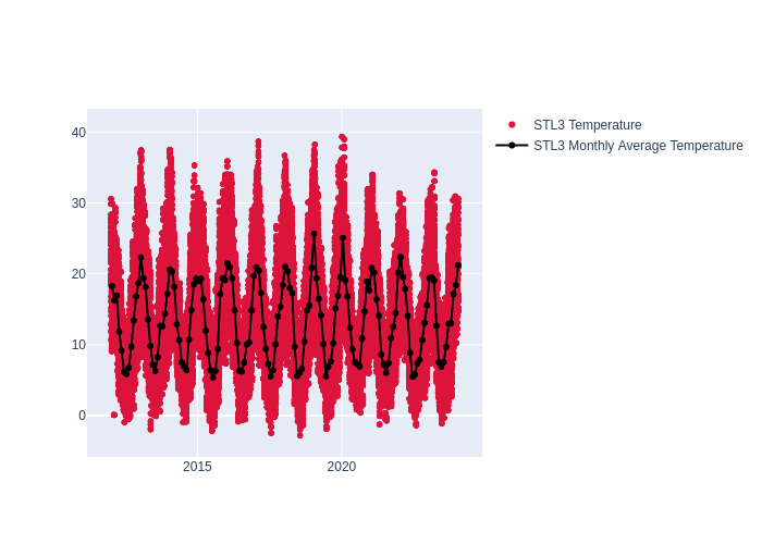 |
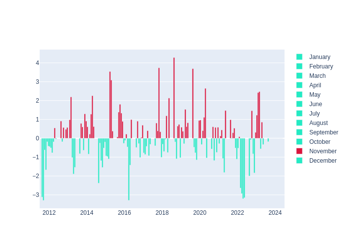 |
Humidity | 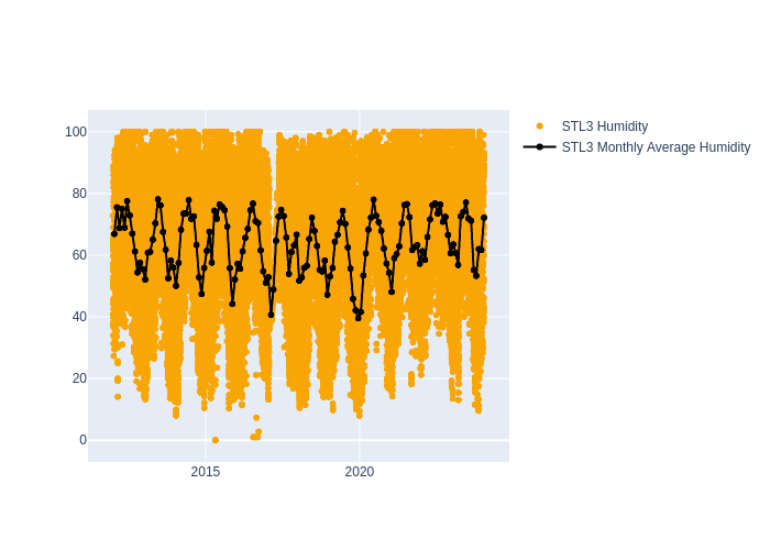 |
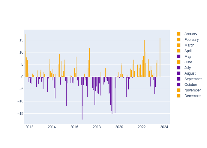 |
| Pressure | 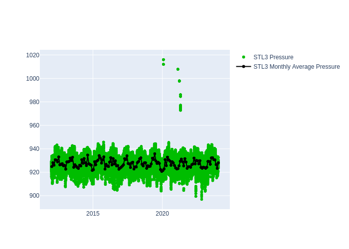 |
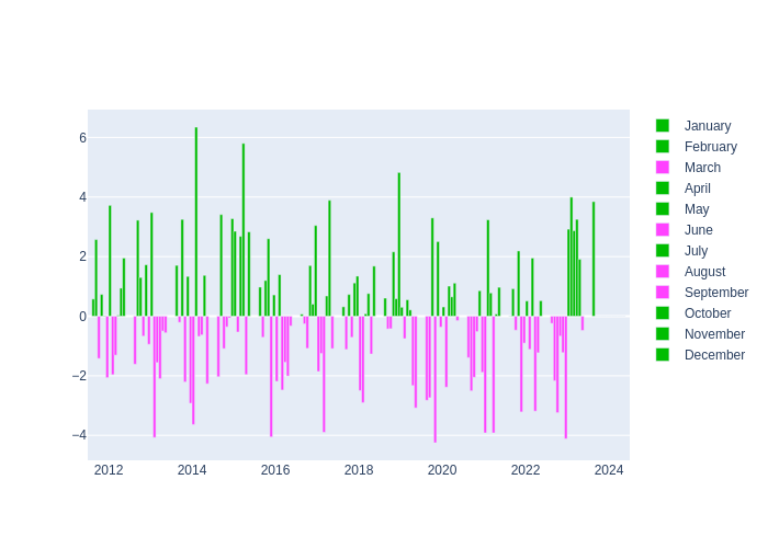 |
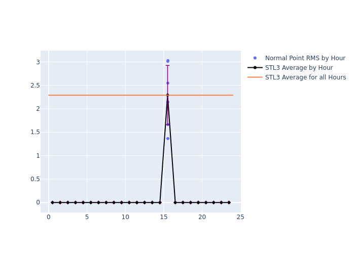
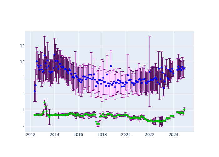
Mt. Stromlo: LAGEOS performance
Note: For a larger view, please select a thumbnail.
| type | Since 2012 | Monthly average |
|---|---|---|
| RMS | 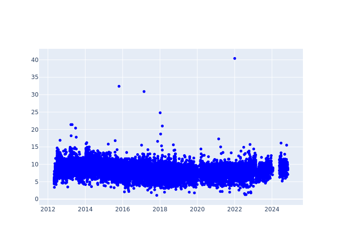 |
 |
| Cal RMS | 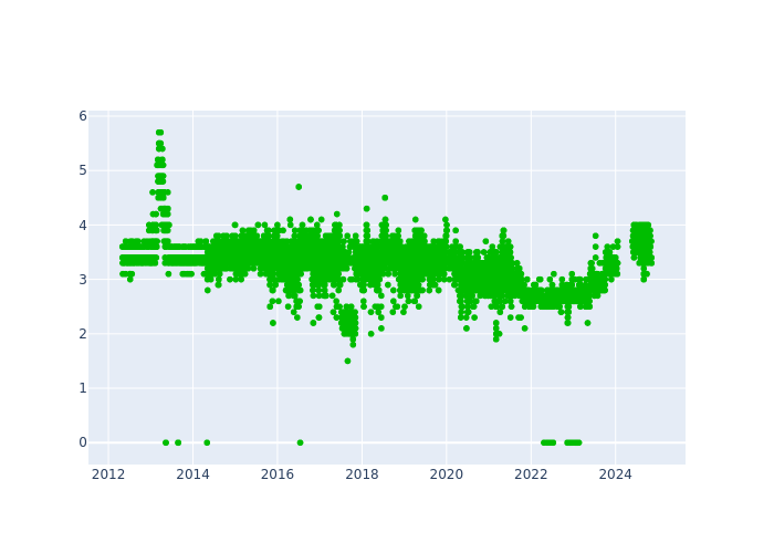 |
|
| Sys Dly | 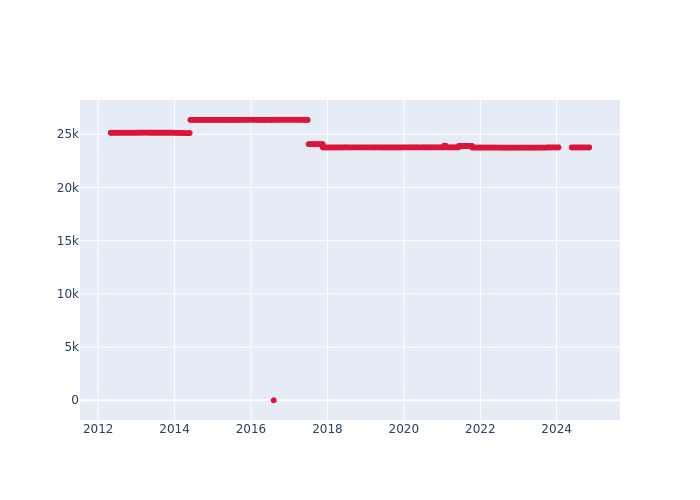 |
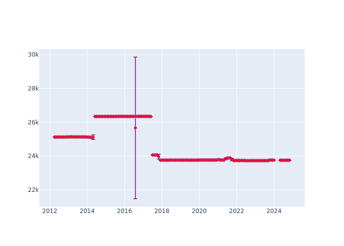 |
| Obs per NPT |
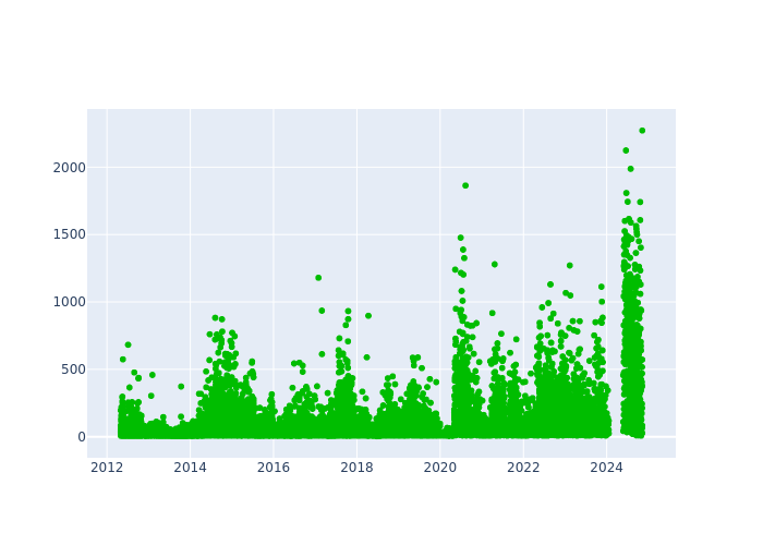 |
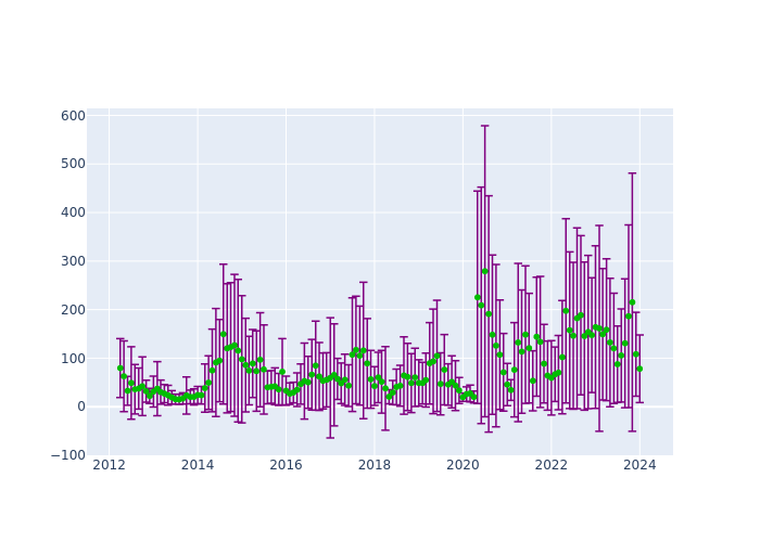 |
| FR Obs per Pass |
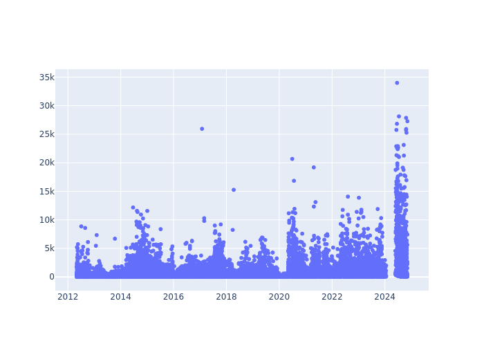 |
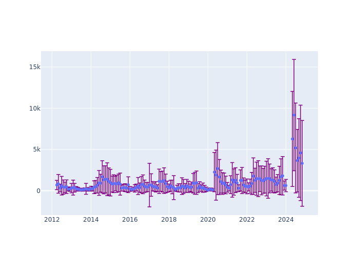 |
Mt. Stromlo: 7-day tracking information
Click on a plot to view a larger image.
| Days ago | |
|---|---|
| 1 | |
| 2 | |
| 3 | |
| 4 | |
| 5 | |
| 6 | |
| 7 |
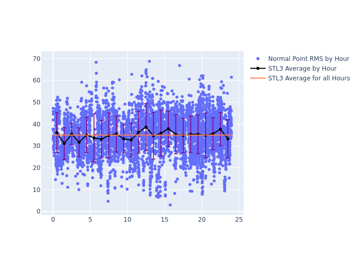
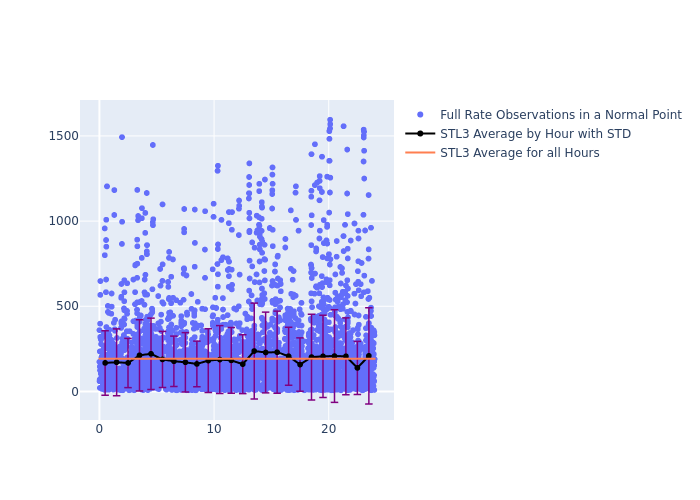
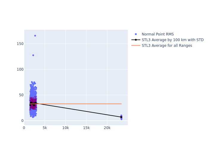
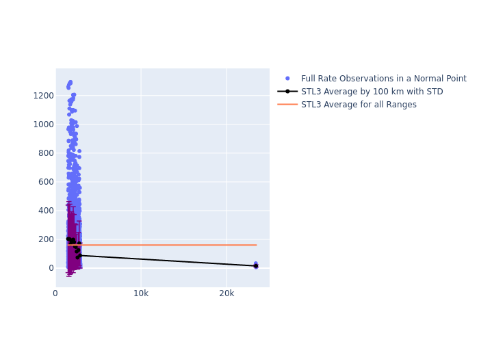
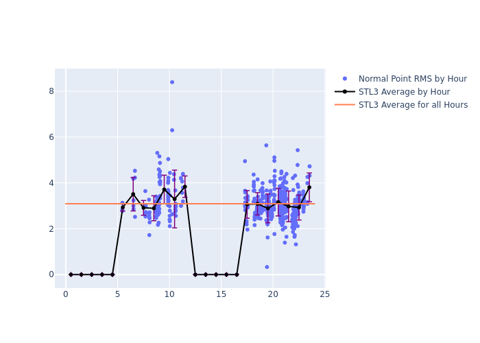
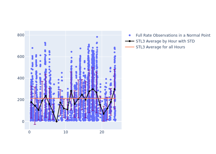
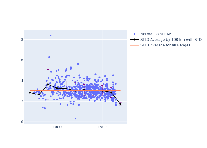
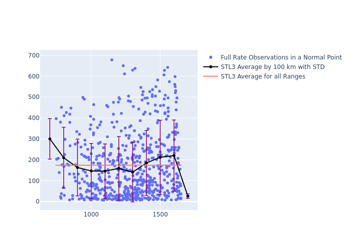
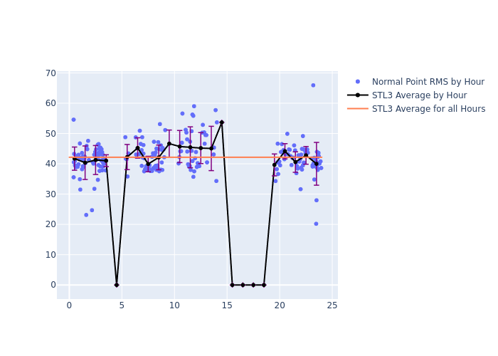
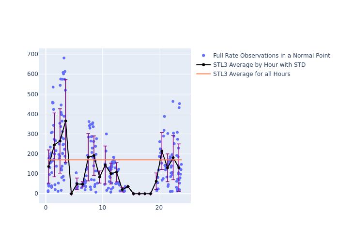
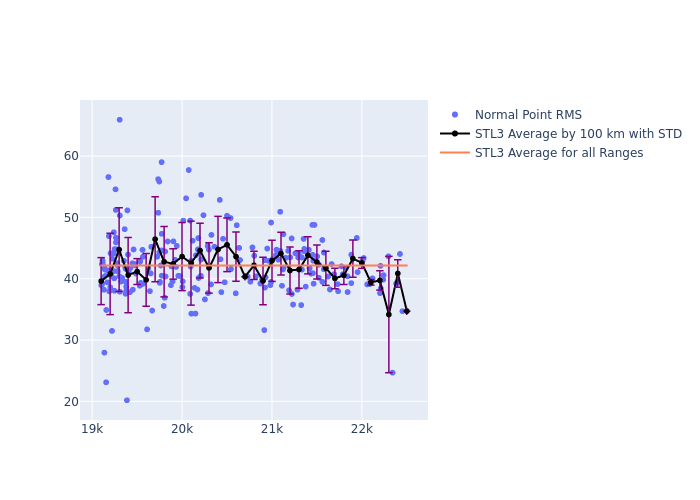
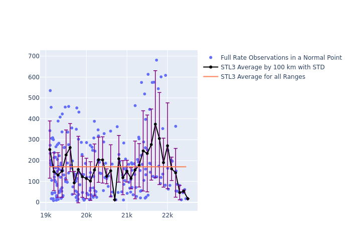
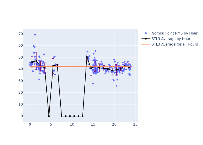
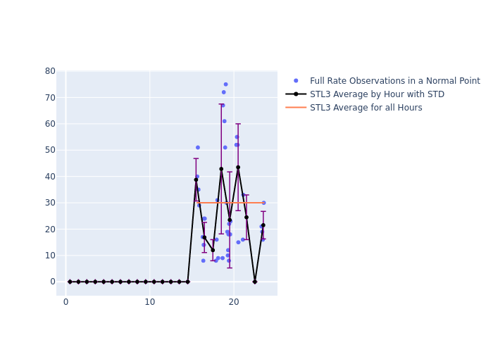
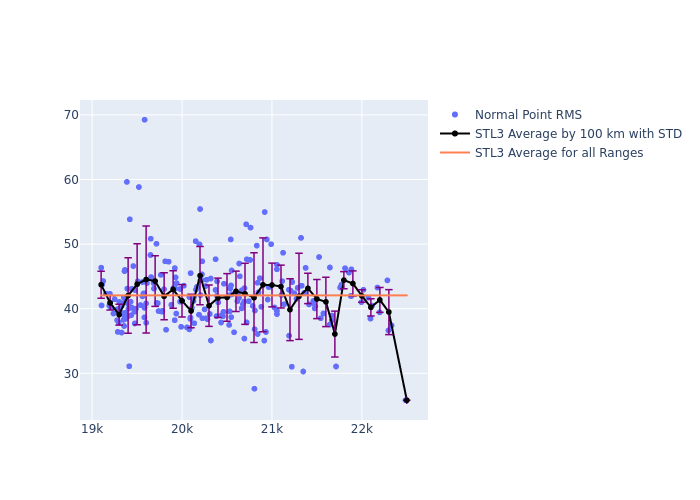
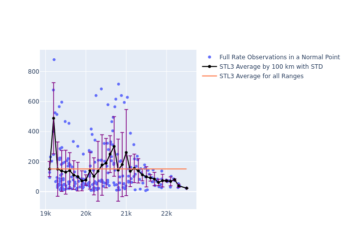
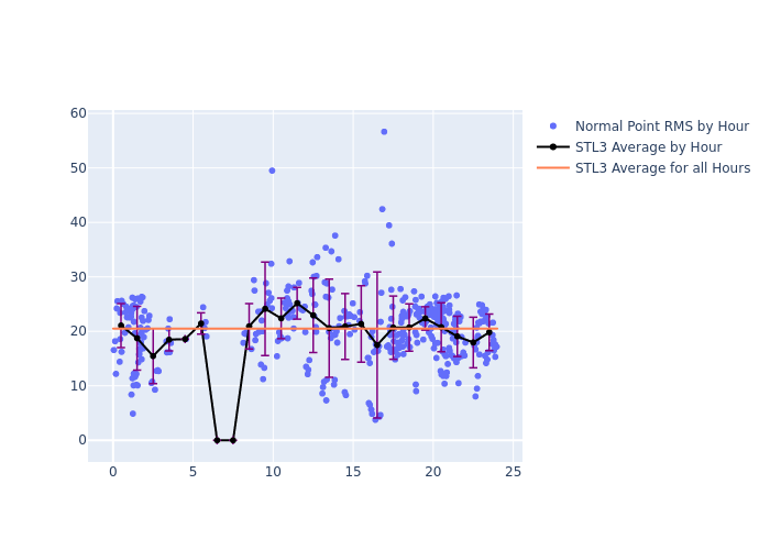
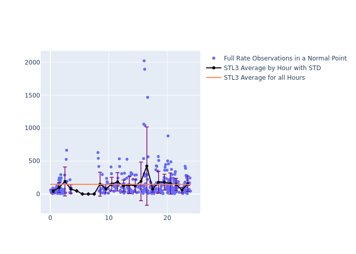
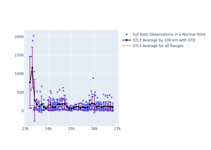
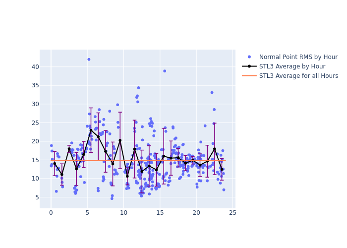
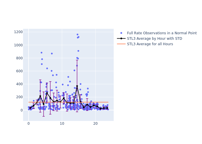
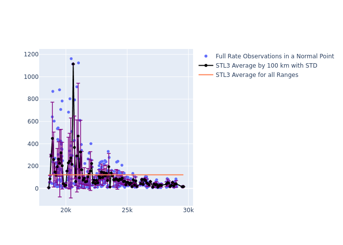
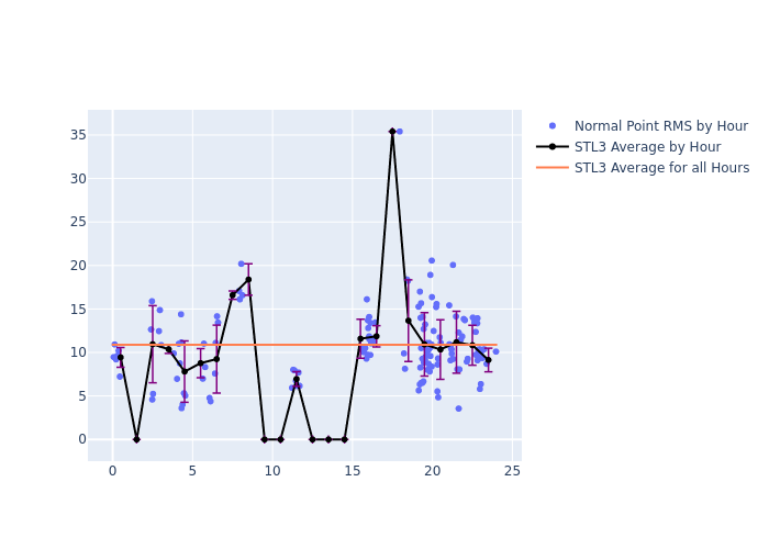
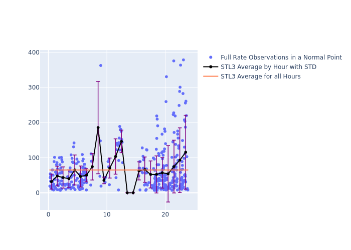
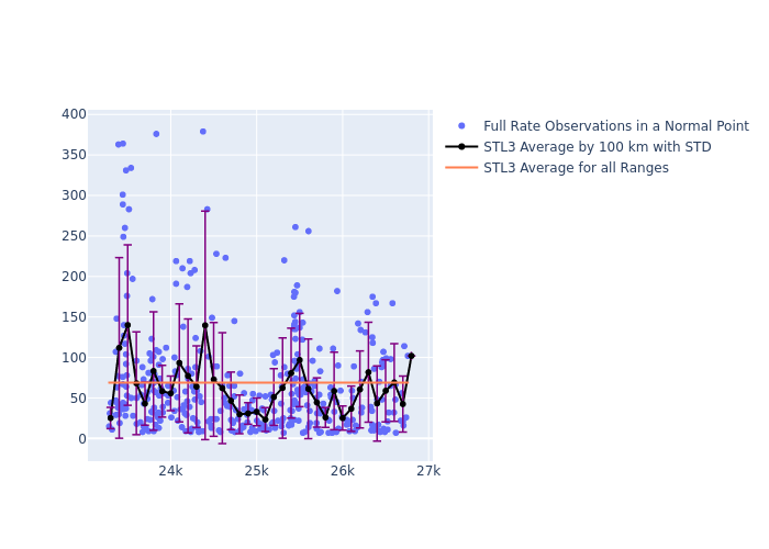
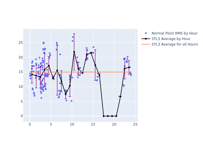
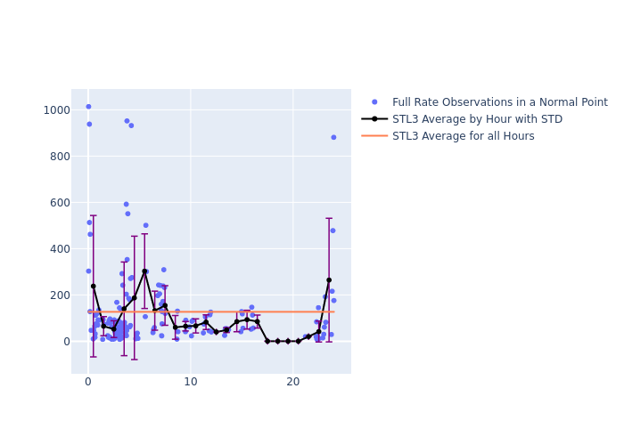
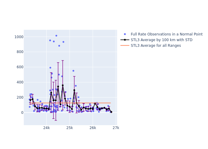
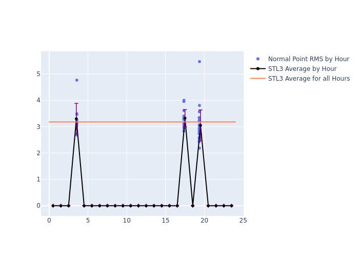
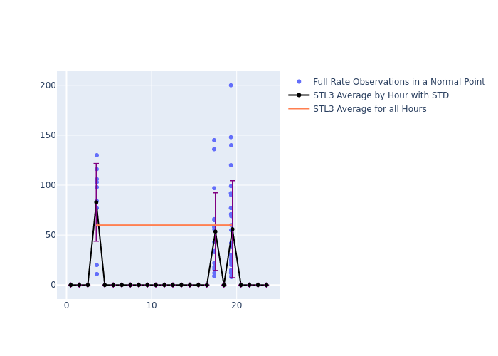
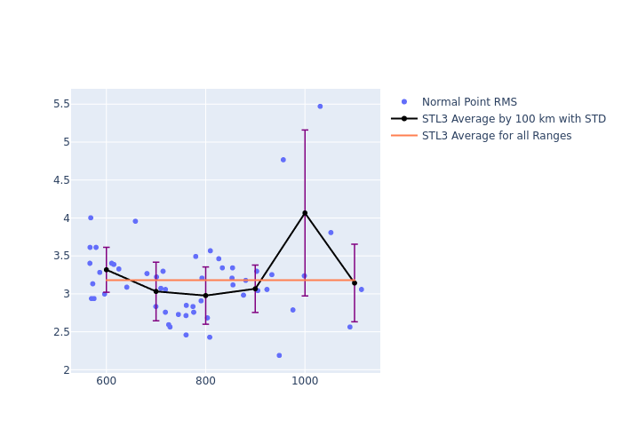
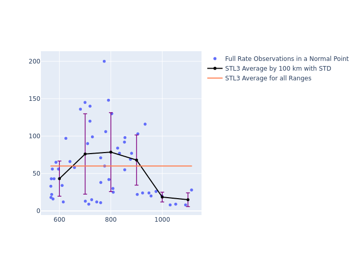
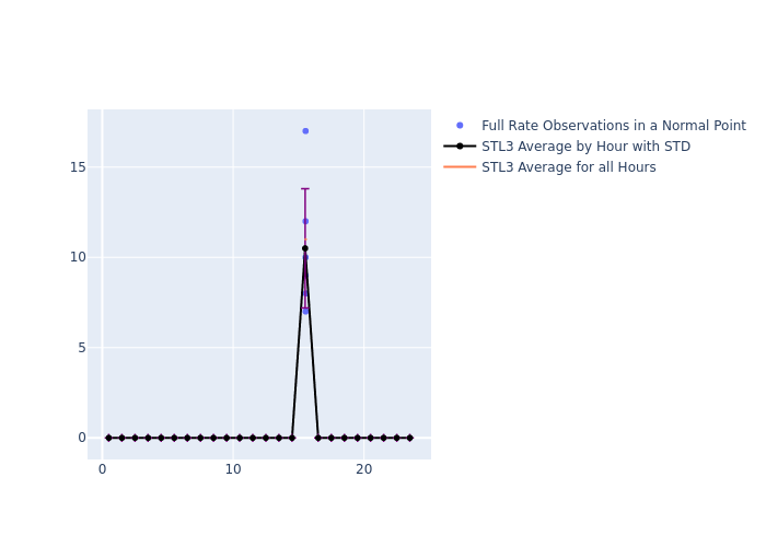
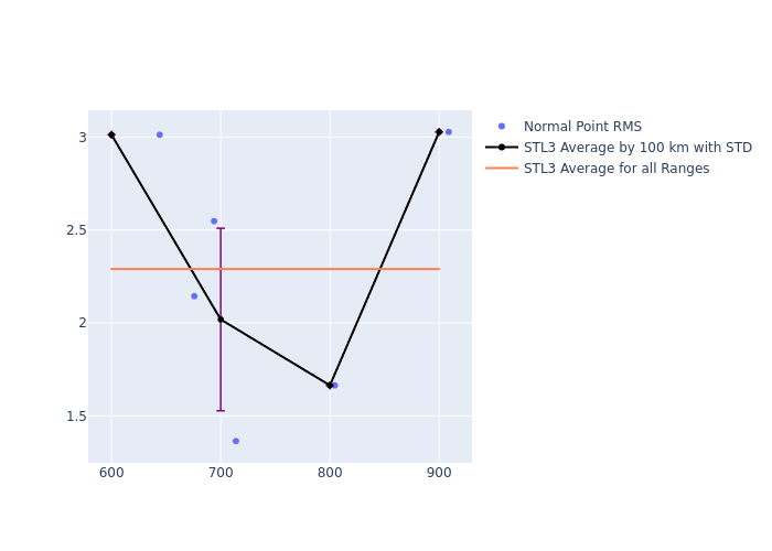
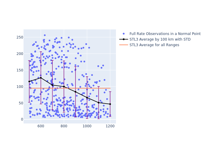
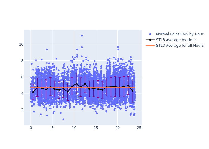
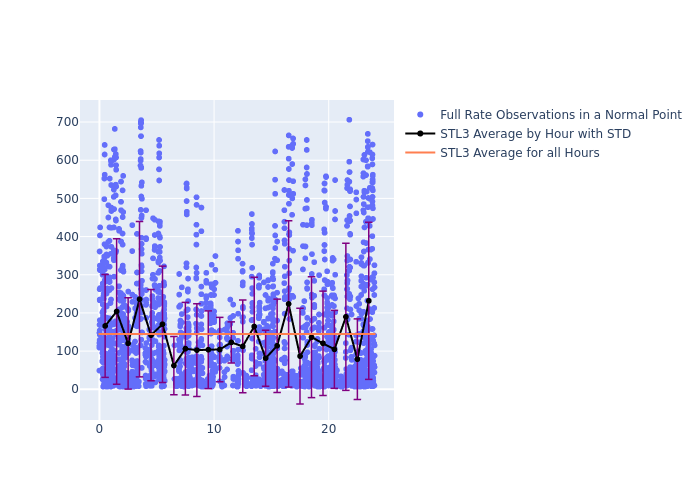
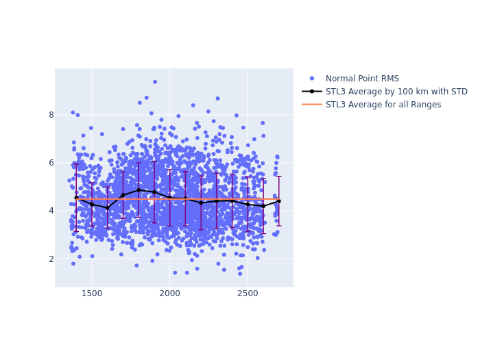
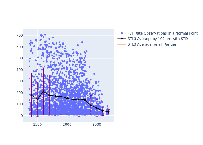
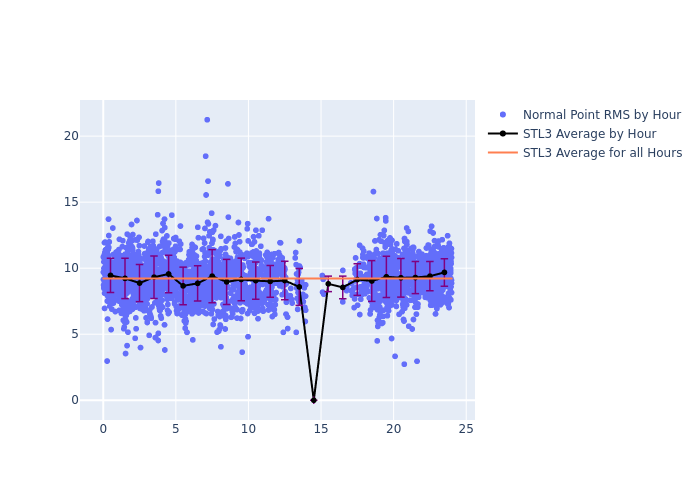
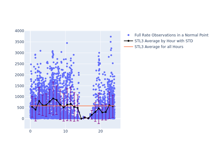
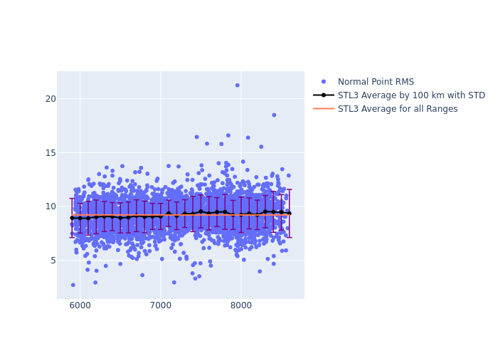
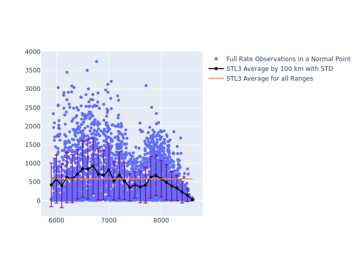
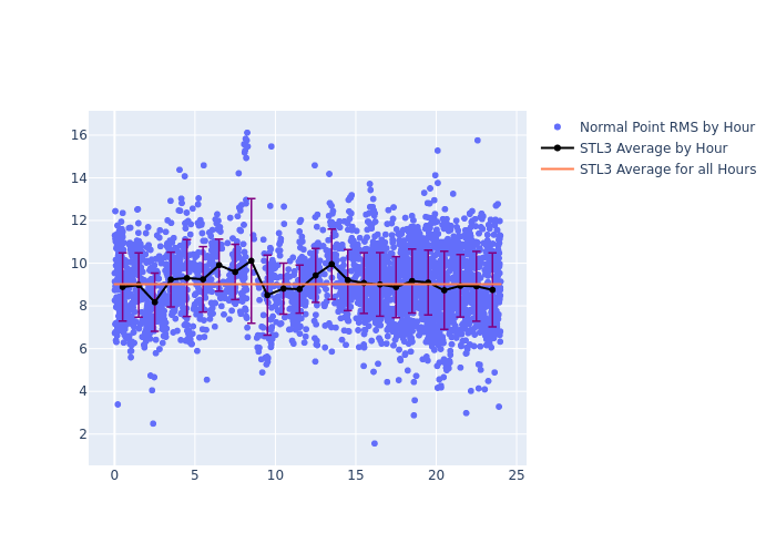
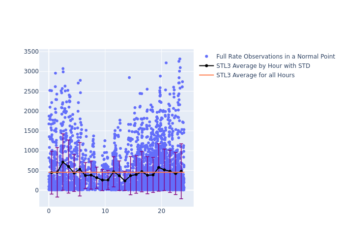
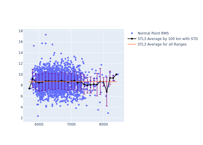
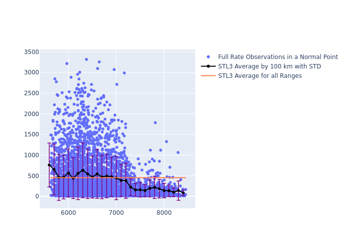
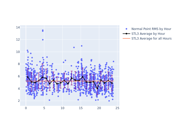
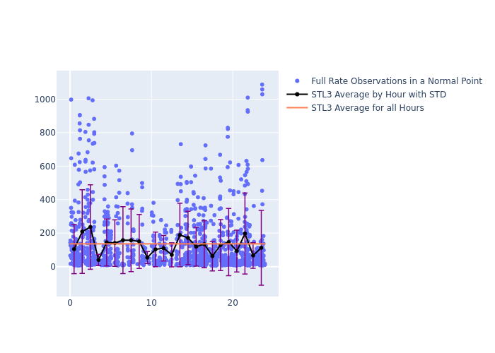
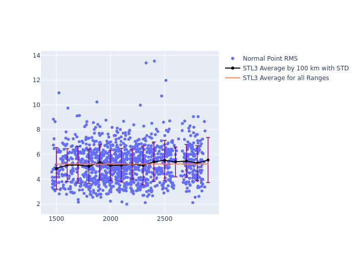
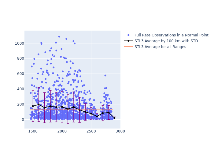
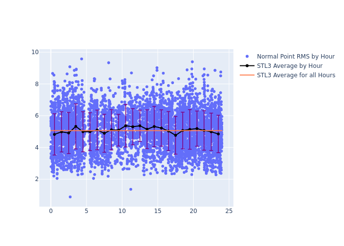
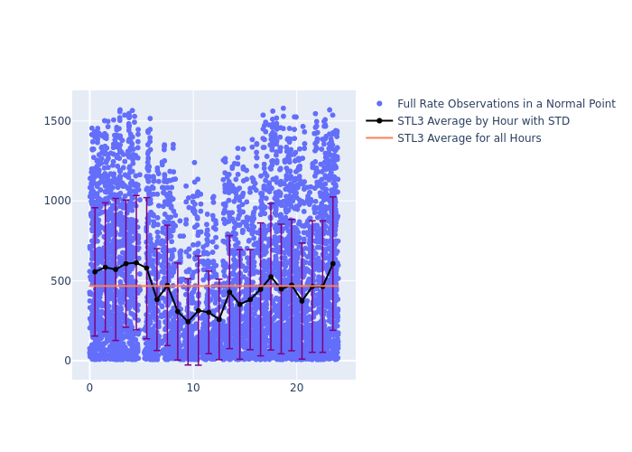
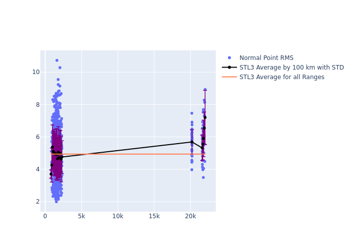
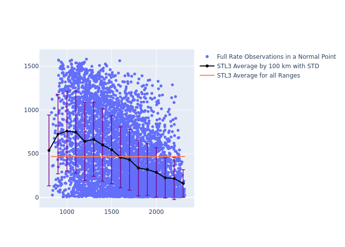
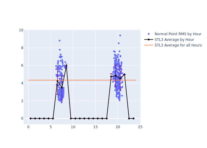
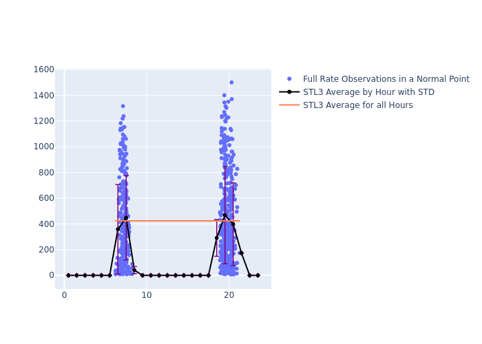
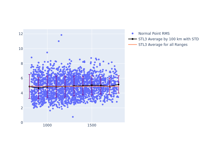
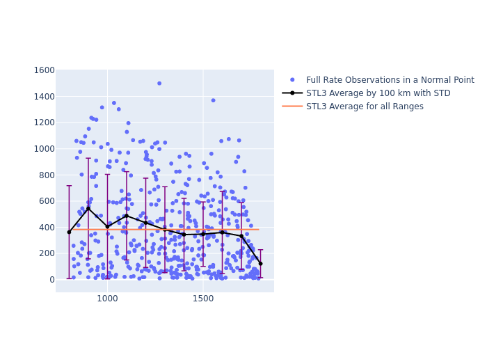
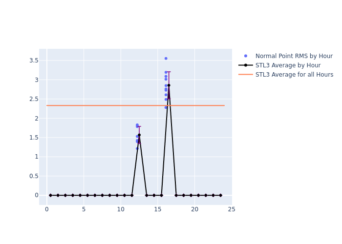
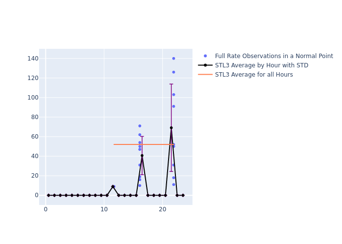
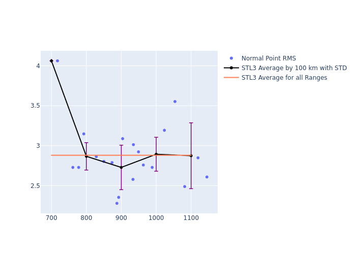
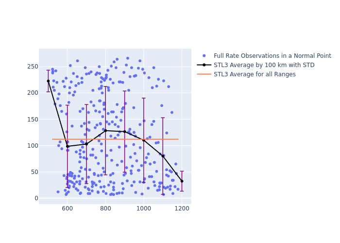
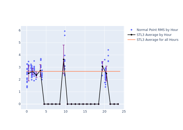
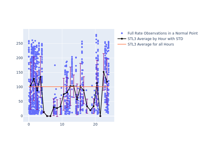
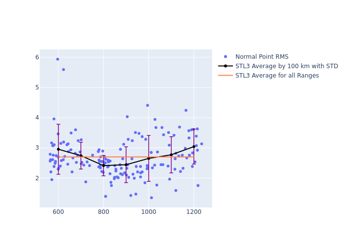
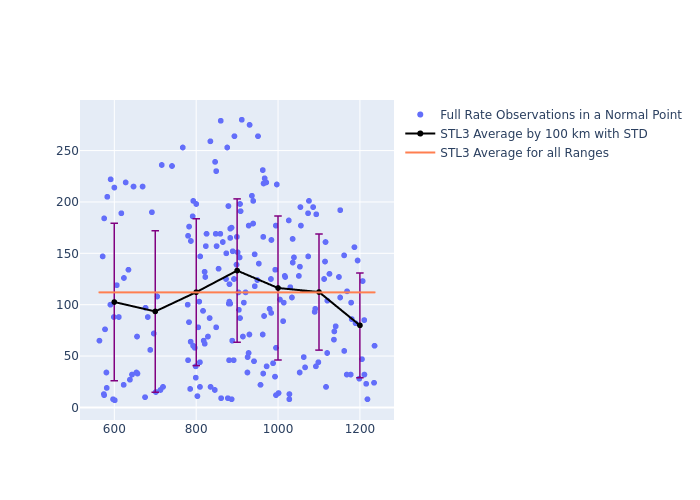
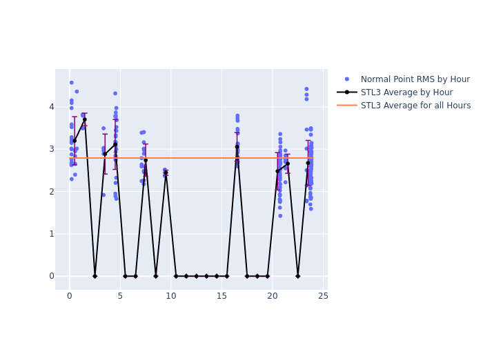
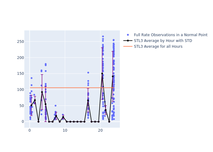
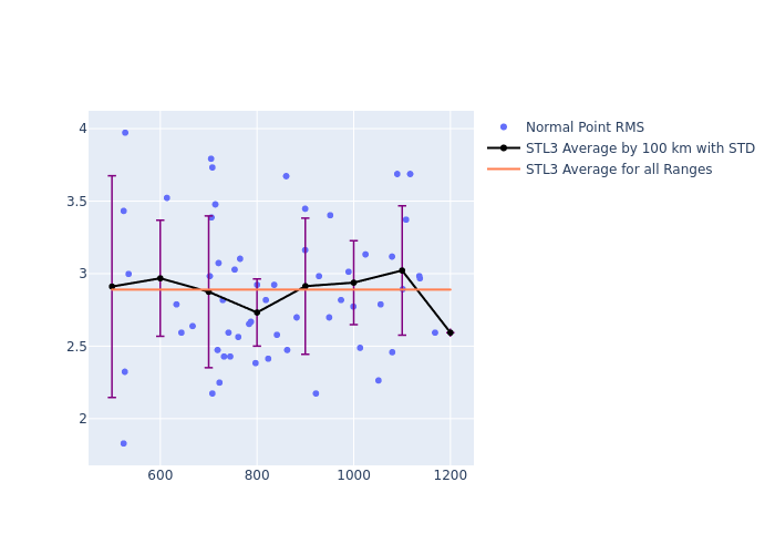
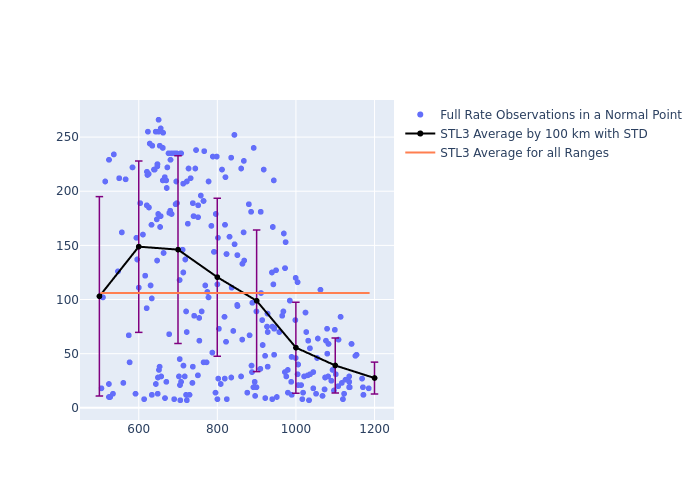
Mt. Stromlo: Satellite Information (as a function of local time and satellite range)
Click on a plot to view a larger image.
- NASA Official: Frank Lemoine
- Web Developers: 610 Web Dev
- Contact Us
- Last modified date: Aug 18, 2021
- Privacy Policy & Important Notices

